The Water's Edge
News and
Views
from the Water's Edge
Site Navigation
[Skip]
SWE - Updates
ENBRIDGE
EMS Resource Links
A Declaration for the Great Lakes....
Maps of the region
Contact SWE
Wisconsin's Public Trust Doctrine
Videos
Site Map
Sand Frac Maps, Diagrams, and Endangered Butterflies
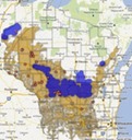
WHERE ARE SAND FACILITIES FOUND IN WISCONSIN 10.29.13
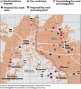
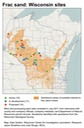
Regional Sand Frac Map - Includes Deposits, mines, proposed mines, processing facilites 10.29.13
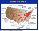
Where is the gas and where does our sand go?
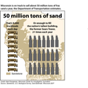
50 Million Tons of Sand a Year
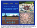
Hydrofracking A Well
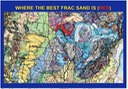
Where is the best Frac Sand Found?
Karner Blue Butterfly an Endangereed Species Threatened by Sand Frackers
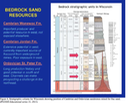
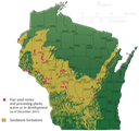
Bedrock Sand Resources in Wisconsin
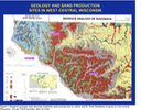
Geology and Sand Production Sites in West-Central Wisconsin
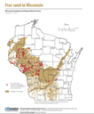
Frac Sand October 2013
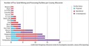
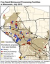
Frac Sand Mining in WI as of July 2012
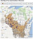
Sand Frac Facilities and Mines Map 2012
December 2011 Sand Frac Sites
July 2011
[Back To Top]